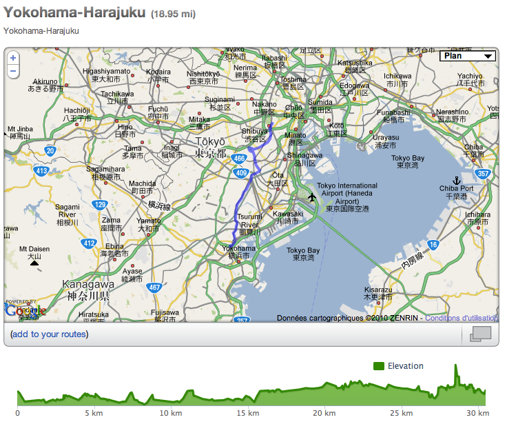
I start to feel better and better. Saturday I took the Fuji Track Comp and rode from Yokohama where I live to Tokyo - Harajuku where I currently work. I always wondered how long it would take. On the map it is only about 30km. A distance I can ride in less than one hour easily when in the countryside, but in an urban environment it is totally different, obviously.
You can't keep a pace and just ride. You have to constantly be careful of the traffic, pass the cars that are bumpers to bumpers, stop at many lights, restart (my ratio was 48x15). So imagine with the heat and the dust it is kind of a nervous ride. Plus I was carrying my messenger type bag… (I am going to buy a more suitable little backpack for cycling, maybe something with a soft bottle inside, camelbak style. Any advices ?)
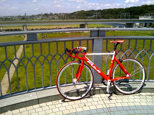
Short break on the Tamagawa bridge, which separate Tokyo and Kanagawa prefectures.
One of my other stops was Komazawa Park, a first time to go there for me (thanks to Alban for the tip). A real sports mecca, many runners, baseball players, skaters, fixed gear fellows etc… I'd like a place like this in Yokohama… Is there one?
The result is that 30km felt (and took) much longer than what I thought but I did it :)
 - Harajuku meijijingumae(office) :)")
At the UltraSuperNew office in Meijijingumae. Time to go back to Yokohama.

To find my way I used the function on Runkeeper that allows you to create routes on google maps, it is very useful especially coupled with the iPhone as you can check where you are. Alas the iPhone battery could not stand the whole ride and on the way back around Jiyugaoka it was out of energy…no more gps. damn…
So I just used the good old method, and asked two times my direction to people.
Arrived at Kikuna I made a mistake and continue to follow the main road instead to take the same shorter way as earlier in the opposite way. As you can see at km 23 (+30km), I had to climb a steep road, very hard with the 48x15 but at least it was a good training for the Fuji San :)

By the way, today I think I decided the way I'll take on d-day. From Yokohama I'll cross Kanagawa Prefecture to reach Gotemba and then make it to the 5th base of Fujinomiya. It is the southern start for the climb of Fuji San, and the shortest way to reach the top as well.From Yokohama to Fujinomiya it is about 112km. Good warm up before the climb :) If anybody thinks this way is a wrong choice, please tell me!
Next saturday I plan to ride from Yokohama to Gotemba (you can spot it on the map), about a 80 km ride (if my route is correct). I will stop just before the hard mountain part. I'll then take a train to get back home for this time.
Links :
Runkeeper : Yokohama - Fuji route details :
https://runkeeper.com/user/JeromeSadou/route/79661
Fuji Track Specs :
https://www.fujibikes.com/Specialty/Track/TrackComp.aspx [en]https://www.fujibikes.jp/track/track_comp.html [jp]
UltraSuperNew :
https://www.ultrasupernew.com
Alban :
https://albancreton.com/
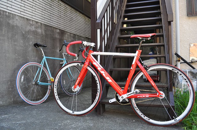
Fuji family, blue Feather and red Track Comp, the old rivalry between the red bike ad the blue bike ;-)